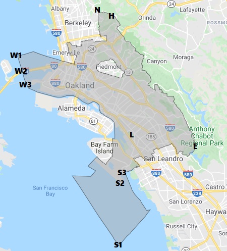
Northernmost (more N details)
A point on the access road behind Summit Dr., adjacent to Tilden Regional Park
Westernmost (more W details)
– Absolute (W1): A point in the Bay outside Emeryville
– Publicly accessible over water (W2): A point on the Bay Bridge two miles west of the Toll Plaza
– Land (W3a): Western tip of Ben E. Nutter Terminal, tw. berths 37 & 38, Oakland Outer Harbor
– Publicly accessible on land (W3b): Western tip of Port View Park
Southernmost (more S details)
– Absolute (S1): A point in the Bay, west of Hayward Regional Shoreline
– Land (S2a): Tip below Runway 30; (S2b) back left of a plane (window seat “A”) about to take off
– In a building (S3a): Far left end of Terminal 2, Gate 32
– Publicly accessible on foot (S3b): Along far end of Edward White Way, at the security gate
Easternmost (more E details)
A point about 110 feet east of the Goldenrod Trail in Anthony Chabot Regional Park, about 1/3rd mile south of the conjunction with Columbine Trail
Center
If you draw lines connecting the absolute extremities they intersect at approximately Foothill Blvd. x 21st Ave.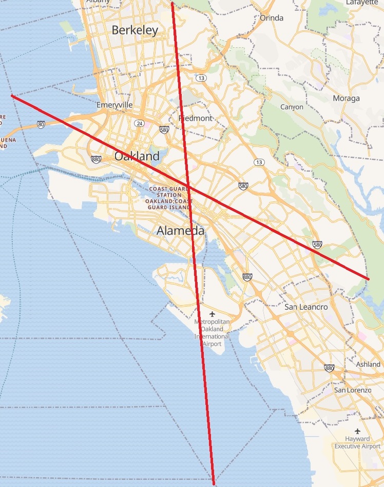
Doing the same thing for the land extremities you’re close to Fruitvale x 880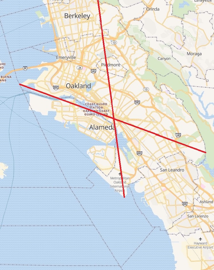
Someday I will carefully cut out a stiff card stock map of Oakland (punching out Piedmont of course) and balance it on my finger to determine the the geographical center. Or maybe someone with GIS skills can generate this for me?
Highest: In the the vicinity of Chaparral Peak, near South Park Way (Tilden Park). However, there seems to be some mapping uncertainty, with two competing points:
1. This USGS map reckoning (also reflected in Open Street Map), along but not above the 1740 ft. elevation contour: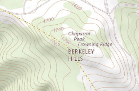
2. The Oakland Planning and Zoning ArcGIS map, also the Alameda County city boundaries map, which with the vertex well beyond the 1760 ft. contour, at 37.8785713, -122.2236329, about 90 feet northeasterly of the above USGS map vertex.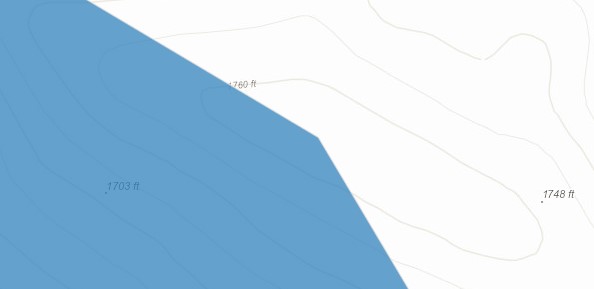
Of course the actual highest point could be anywhere along the line segment along 1740 ft. in #1, or within the area above the 1760 ft. contour in #2.

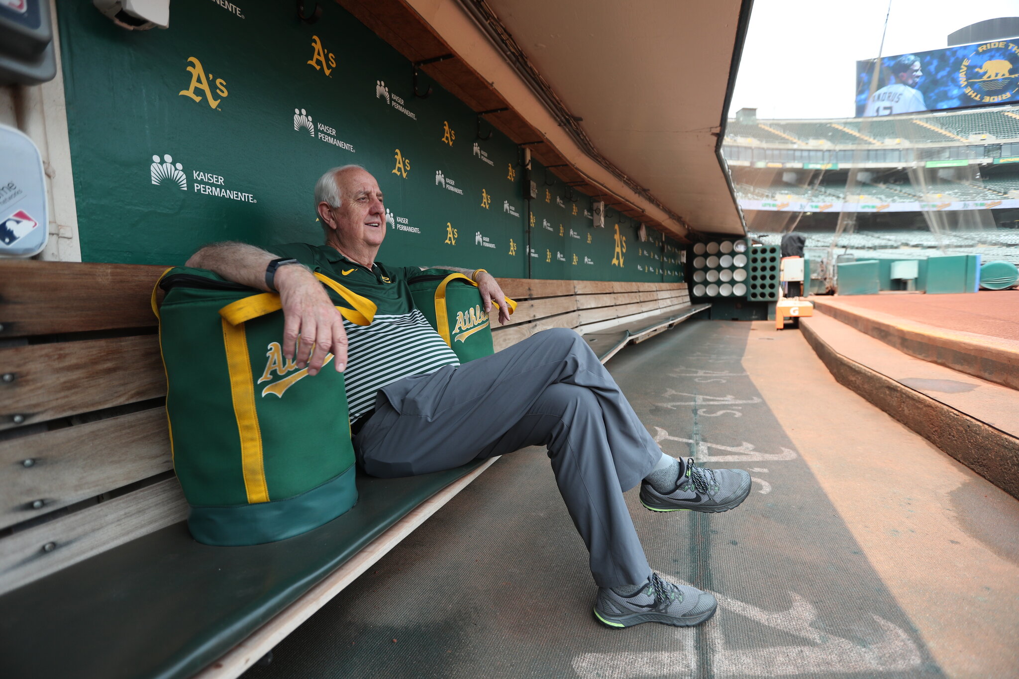
Lowest: probably the dugouts at the Coliseum (field is -21 ft, so about -22 ft)